 BIM Ops Studio
Mine maps · 3D · parcel level
Old underground mines, in 3D under today's ground.
The coal companies' own survey maps, placed on the modern map and shown at depth under the real terrain, with the parcels and buildings that sit above the workings. Pick a location on the map, or order a site report for one parcel.
Every location
More regions added as they are mappedThe original survey
Each scene starts from the mining company's own map, from public state archives.
Placed and checked
Placed on the modern map from printed grids, streets, rail and streams, then checked against the state's own placement.
Shown in 3D
Workings at the depths written on the map, under USGS lidar terrain, with every building above clickable for its address.
Site screening report · King County, WA
Is there an old coal mine under this parcel?
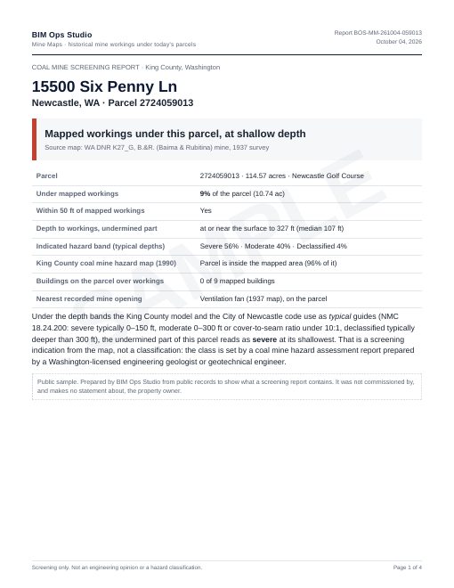
A four-page PDF for one parcel, built from the mining company’s own survey map, placed and checked on today’s ground. For engineers, geologists, environmental consultants, developers and buyers who need the answer before a coal mine hazard assessment, a purchase or a design.
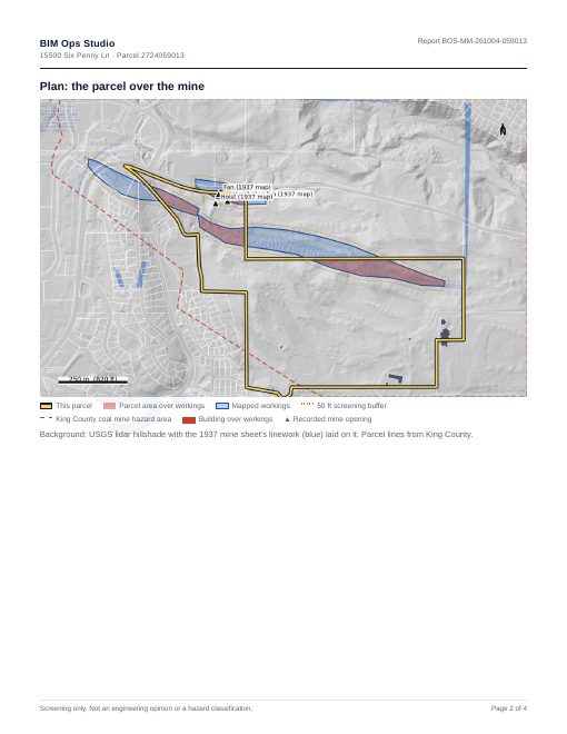
- How much of the parcel lies over mapped workings, and anything within 50 ft
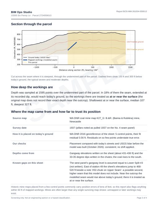
- Depth to the workings across the parcel, with a section drawing
- Screening against the county’s typical severe / moderate / declassified depths
- King County coal mine hazard map, buildings over workings, nearest recorded mine opening
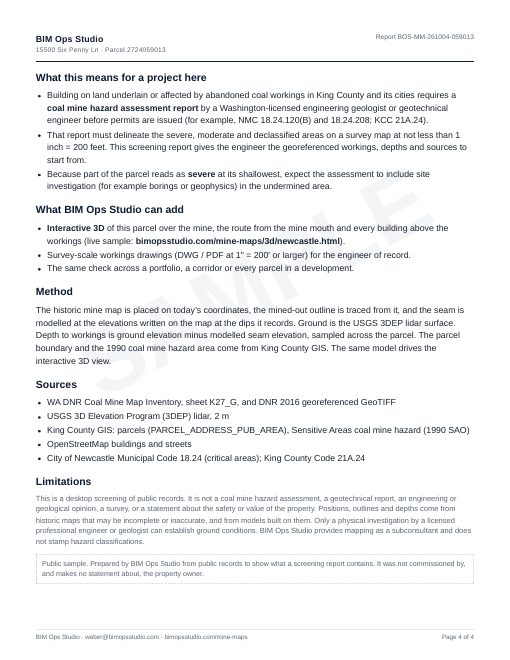
- Where the map came from, how it was placed, and how far to trust it
Sample: Newcastle Golf Club parcel, prepared from public records only. Open the sample report (PDF)
Facts and limits
What the 3D views are built from
- The mining company's own survey sheets, from public state archives (PA DEP / PASDA, WA DNR).
- Placement from printed coordinate grids, streets, rail and streams. In a blind test on six gridded sheets, every one landed within 50 m of the state's own placement and five within 20 m (6–22 m).
- Seam depth from floor elevations written on the sheets, under USGS 3DEP lidar terrain.
- Parcels, buildings and addresses from county GIS and assessment records.
What they are not
- Not a geotechnical report, property disclosure or engineering opinion.
- Old maps can be incomplete: workings after the survey date, robbed pillars and unmapped entries may exist.
- Where a view simplifies (for example a seam drawn as a flat or tilted plane), the view says so.
- Absence of a mapped mine is not evidence that no mine exists.
Required before any decision
Before buying, designing, permitting or building on a site near mapped workings, the actual conditions must be confirmed by a physical site investigation: borings and/or geophysical survey, carried out and signed by a licensed professional engineer or geologist. Some jurisdictions require it by code; in King County, Washington, a coal mine hazard assessment by a Washington-licensed professional is required before permits in mapped hazard areas.
We prepare the historical mapping that such an investigation starts from. Order a site report for a specific parcel.